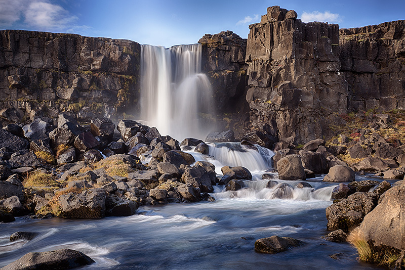
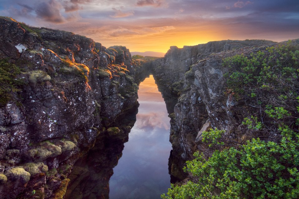
It was at Þingvellir that the national assembly was established around 930 and continued to convene there until 1798. Many historically significant event have taken place at Þingvellir and therefore it is at the heart of Icelandic nationhood. Þingvellir is Iceland’s oldest National Park and is now on the UNESCO World Heritage List. The geology of the area is no less remarkable and has been listed as a national park since 1928 because of the special tectonic and volcanic environment. The Þingvellir area is part of a fissure zone running through Iceland, being situated in the tectonic plate boundaries of the Mid-Atlantic Ridge. Þingvallavatn is partially located in the Þingvellir National Park and is the largest natural lake in Iceland with a surface of 84 square kilometres and depth up to 114 metres. The lake has a unique and fascinating ecosystem that has been subject to a lot of research. The relationship between the lava and the lake make is particularly fertile and rich in vegetation and a large amount of algae, despite the cold temperatures. In the last few decades, research has proven Þingvellir to be a natural wonder on an international scale with the geologic history and Lake Þingvallavatn’s biosystem forming a unique entity and stunning scenery. The continental drift can be clearly seen in the cracks or faults which are traversing the region with the biggest one, Almannagjá being the best known. This also causes the frequent measurable earthquakes.
Peningagjá, or The Money Chasm, is a deep fissure filled with crystal clear spring water. It is a tradition to throw coins into it from the bridge that lies across. The coins give off strange reflections as they drop through the water and it is said that if you can follow the coin all the way down until it comes to rest on the bottom, your should make a wish as it might come true.
Þingvellir National Park offers travellers with endless opportunities for recreation and adventure. There are a number of hiking trails and camping sites in the area along with excellent conditions for angling and fishing. Diving is permitted in two submerged rifts in the National Park, Silfra and Davíðsgjá. Silfra is one of the best diving spots in Iceland due to its astounding visibility in the cold and clear ground water and the magnificent underwater landscapes.
My visit
Iceland
The cornerstone of Icelandic culture is the Icelandic language, which has spawned a literary tradition that dates back to the ancient Icelandic Sagas. These are tales of violent blood feuds, traditions, family, and character.
ID: 700910-0750 VSK Nr: 106233
MY VISIT ICELAND IS
OPERATED BY FERÐAVEFIR